Sorocaba/SP · Urban Planning, Territorial Planning and Masterplan
The Project
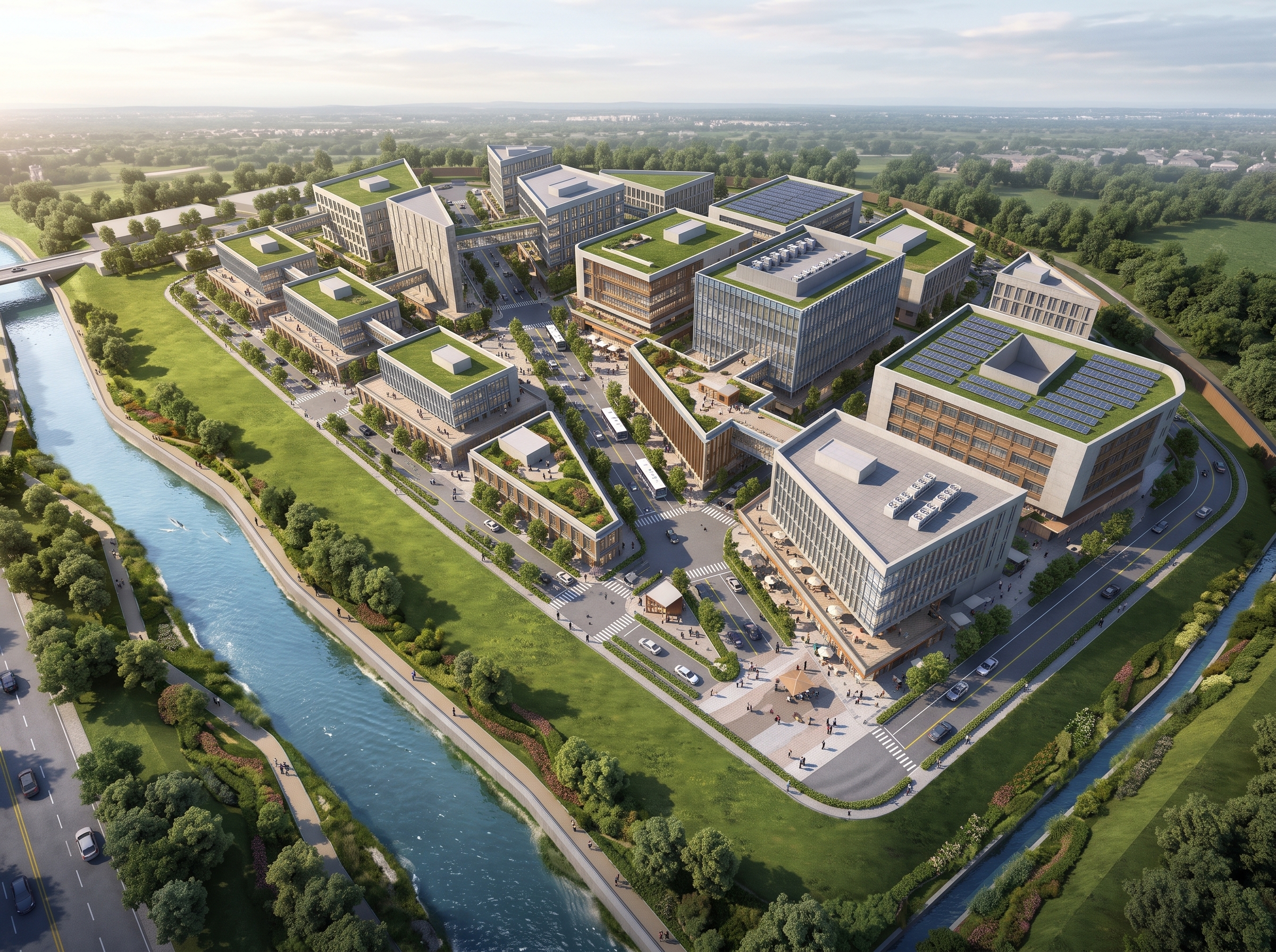
The Smart Neighborhood Masterplan is an urban and territorial planning proposal developed for a site of approximately 241,000 m², located near the central area of Sorocaba, São Paulo, alongside the Sorocaba River.
The conceptual study proposes creating a neighborhood with integrated uses, bringing together housing, commerce, services, institutional facilities, public spaces and urban infrastructure in an environment planned to promote quality of life.
The proposal seeks to reconcile urban development, sustainable mobility and environmental enhancement, establishing guidelines for a more compact, connected pattern of development integrated into the city’s dynamics.
Site Layout and Territorial Organization
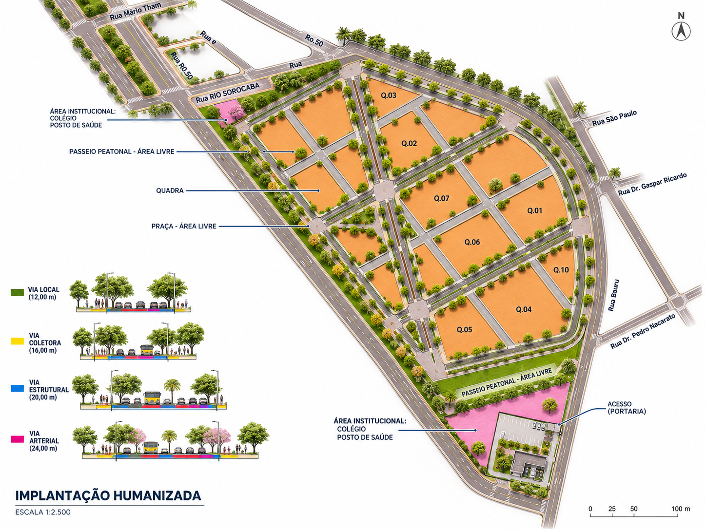
The masterplan structures the site through urban blocks, main avenues, local streets and pedestrian circulation spaces, connected to a central square and open areas near the Sorocaba River.
The territorial organization considers the distribution of residential, commercial, service and institutional uses, seeking to bring housing, work, leisure and urban facilities closer together.
The design establishes a connected urban grid, with different circulation options, public spaces and gathering areas, emphasizing the relationship between buildings, infrastructure and the natural landscape.

The illustrative site plan presents the conceptual organization of the blocks, the distribution of institutional areas and open spaces, and the hierarchy of the road network. The study establishes land-use and circulation guidelines to direct the proposed urban development.
Urban Planning Strategy and Territorial Integration
The urban planning strategy begins with an assessment of the site’s characteristics and its position within the city, considering its proximity to the urban center, the presence of the Sorocaba River and opportunities to connect with existing infrastructure.
The concept brings together five planning principles: urban compactness, connectivity, social inclusion, resilience and cultural vitality. These guidelines inform the organization of a multifunctional neighborhood, with a diversity of activities and spaces capable of encouraging urban life.
The proposal also values the relationship between building frontages and public spaces, seeking to establish continuity between the neighborhood’s different sectors and strengthen the connection between urban development and nature.
Mobility and Accessibility
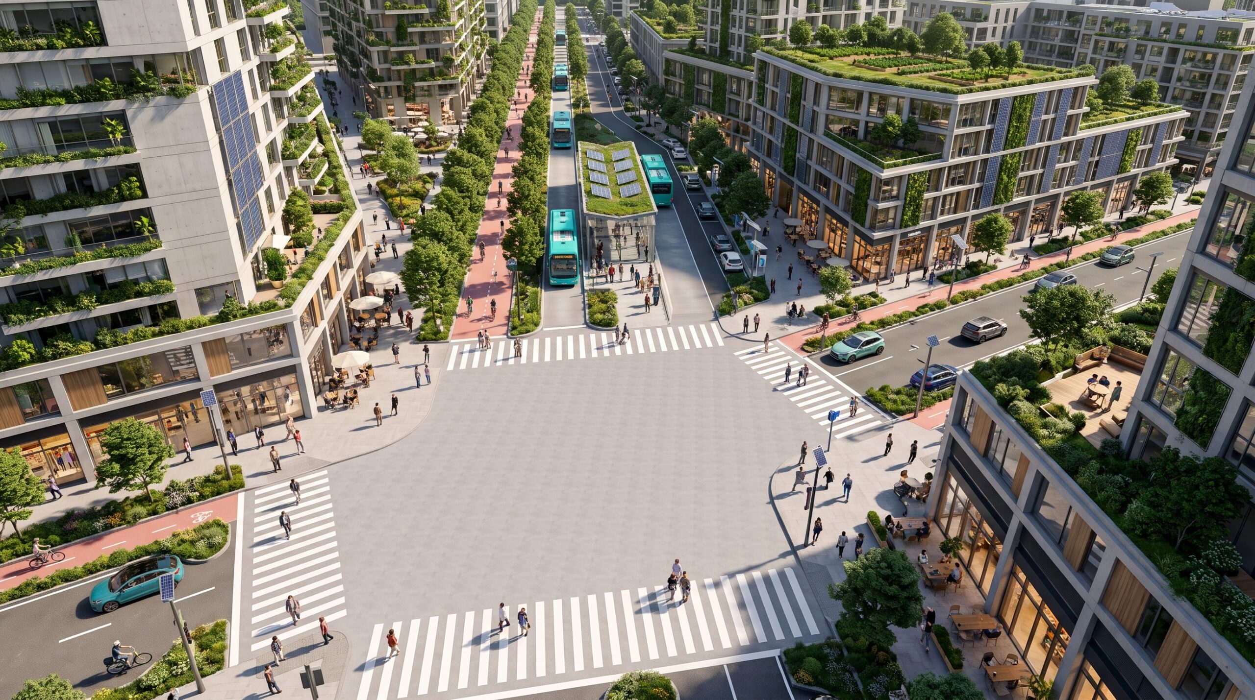
The mobility system was conceived around a hierarchy of streets, including main avenues, residential streets and access connections to the various blocks and urban facilities.
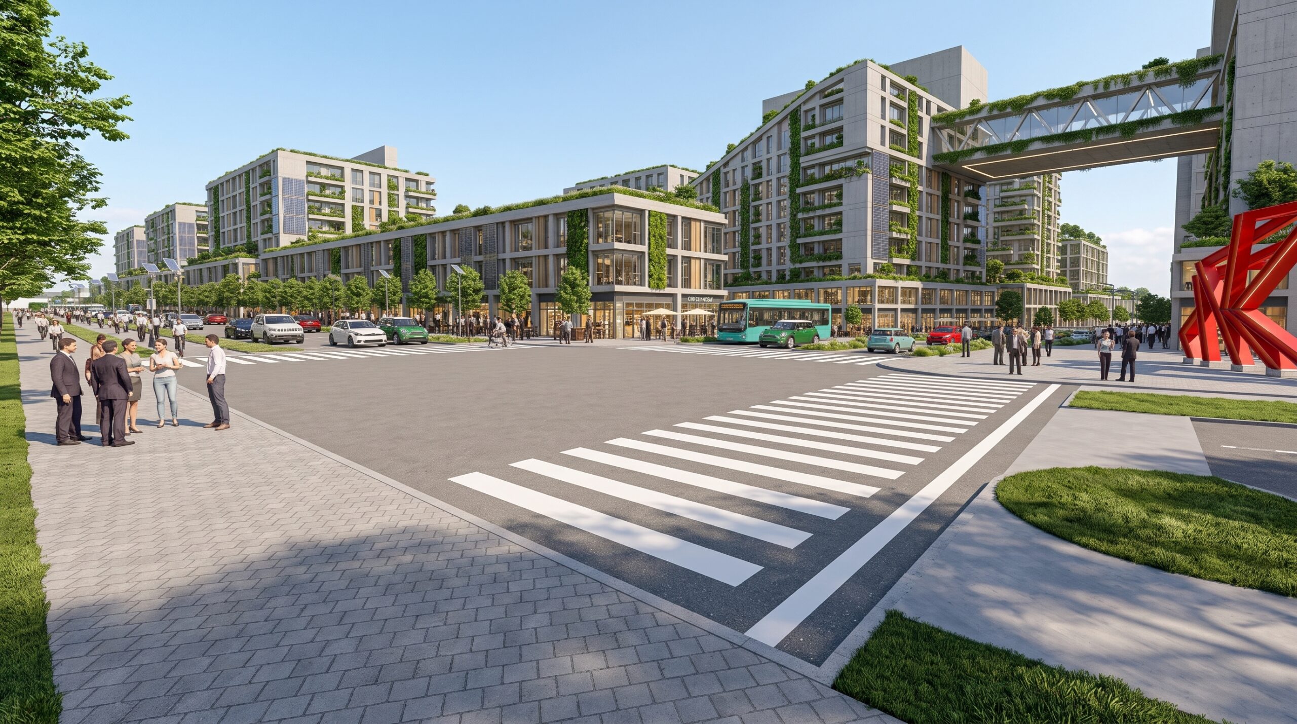
Sidewalks, pedestrian crossings, cycle routes, trees and shared circulation spaces are part of the project guidelines, aiming to promote safety, accessibility and more sustainable travel.
The road network organization seeks to reduce dependence on long-distance trips by bringing different urban uses closer together, while creating conditions for pedestrian and cyclist circulation and future integration with public transport systems.

Architecture and Mixed Uses
The urban planning proposal establishes guidelines for buildings of different types, combining residential, commercial, service and institutional uses within the same urban development.
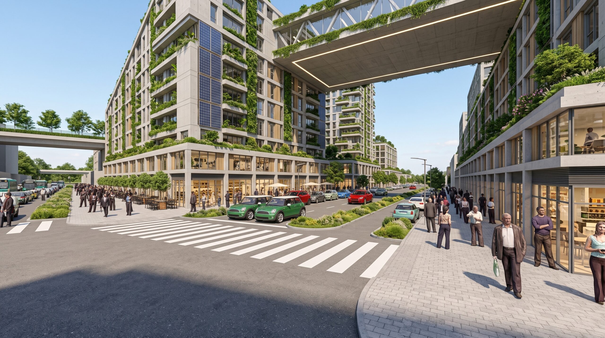
The illustrative architectural language explores contemporary façades, active ground floors, transparency and integration between indoor and outdoor spaces, seeking to strengthen the relationship between buildings and street life.
The diversity of uses and proximity between activities are considered essential to the neighborhood’s vitality, contributing to a dynamic urban environment with opportunities for social interaction throughout the day.
Public Spaces and Social Interaction
Public spaces are central elements of the proposal, organized through squares, pedestrian promenades, green areas and routes connecting the urban blocks and the development’s various sectors.
The central square and internal circulation spaces were designed as places for meeting, lingering and social integration, encouraging collective use of urban environments.
The relationship with the Sorocaba River also guides the planning of open spaces, seeking to enhance the natural landscape and create opportunities for leisure, social interaction and contact with the riverside environment.
Implementation Guidelines
The case study establishes a conceptual land development proposal whose implementation will depend on further technical studies, coordination of infrastructure and applicable urban planning and environmental approvals.
The masterplan’s organization allows for progressive development, coordinating the implementation of the road network, public spaces, buildings and institutional facilities in accordance with future technical and economic conditions.
The proposal provides a preliminary reference for the development of the site, allowing for adjustments during subsequent planning and design stages.
Project Information
- Project: Smart Neighborhood Masterplan — Villares Site
- Location: Sorocaba, São Paulo, Brazil
- Year: 2024
- Study area: 241,156.95 m² (approximately 24.12 hectares)
- Project type: Urban Planning, Territorial Planning and Masterplan
- Scope: Case study, territorial organization, urban planning guidelines, road network, active mobility, public spaces and environmental integration
- Technical development: LUCO Arquitetura e Urbanismo
- Stage: Case Study and Conceptual Masterplan.
The images shown are illustrative visualizations of the conceptual study, developed with the support of digital tools and artificial intelligence. They do not represent detailed design documentation, an approved development plan or a completed development.